Apps for Drones: Navigating the Skies with Advanced Technology

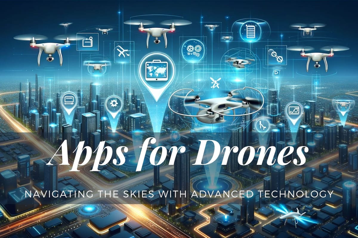
Exploring the latest apps for Drones, I discovered a world where technology transforms our skies. These apps aren't just tools; they're gateways to unparalleled aerial adventures and innovations. Join me as we dive into how these applications are reshaping our interaction with drones, offering not just control but a revolution in flight experiences.
Drones have revolutionized photography and exploration, offering unique perspectives from the skies. However, the key to maximizing their potential lies in the apps that accompany them. From flight planning to capturing breathtaking images, drone apps play a crucial role in every aspect of drone usage.
Apps for Drones
Key Takeaways
- Understand the significance of drone apps in enhancing flying experiences.
- Discover apps that provide critical information on flight safety and regulations.
- Explore advanced tools for drone photography and flight planning.
Essential Drone Navigation Apps
AirMap: A Comprehensive Guide for Safe Flying
AirMap stands out as a must-have for every drone pilot, irrespective of their purpose - be it commercial or recreational. This app's significance lies in its ability to provide real-time, location-based flight restriction information, a feature indispensable in today’s congested airspace. Furthermore, with laws for UAVs in over 20 countries, AirMap is a boon for globetrotting drone photographers.

Hover: Simplifying Flight Safety and Planning
Hover is another essential tool, providing real-time data about air traffic and weather conditions. Its simplicity and comprehensive approach make it an ideal app for both novice and experienced pilots, ensuring safer flight planning and execution.
Google Maps: The Drone Photographer's Planning Tool
For any drone photographer, Google Maps is invaluable. It helps in scouting potential photo locations and determining the best launch points for your drone. This app is particularly useful for planning detailed photography trips and is a staple in the toolkit of many drone enthusiasts.
By incorporating these additional apps into your drone operations, you can further enhance your flying experience, ensure compliance with regulations, and explore new opportunities in the world of drone technology.
Advanced Photography and Flight Planning Apps
DJI Go 4 and Litchi: For Stunning Aerial Shots
DJI Go 4 and Litchi are essential apps for those looking to capture stunning aerial photographs. DJI Go 4 is tailored for DJI drones, offering features like Quickshot and Active Track, while Litchi provides advanced flight planning capabilities. Both apps are crucial for taking your drone photography to the next level.


PhotoPills: Elevating Drone Photography
PhotoPills is a versatile app that offers a plethora of features, from planning sunsets and sunrises to understanding the best light conditions for drone photography. It’s a favorite among drone photographers for its Planner and Sun pills features, which help in visualizing the perfect shot.

Drone Harmony: Automated Flight Planning for Complex Missions
Drone Harmony is tailored for advanced drone missions, offering automated flight planning capabilities. This app is particularly useful for pilots conducting complex tasks such as surveying, mapping, or industrial inspections. Its ability to create precise flight paths and automate repetitive tasks makes it a valuable tool for professionals looking to optimize their drone operations.
 Danny Elassad, Chief Remote Pilot, Hoverscape
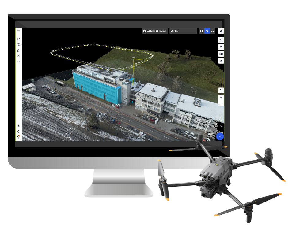
Flight Plan for DJI Drones: Enhanced Flight Planning Features
Flight Plan for DJI Drones is a specialized app for DJI drone users, offering enhanced flight planning features. It allows pilots to pre-program flight paths, set waypoints, and automate camera actions. This app is essential for those looking to execute complex flights with minimal manual intervention, especially in photography and videography projects.

Skyward.io: Professional Flight Planning and Management
Skyward.io is designed for commercial drone operations, offering a comprehensive suite of tools for flight planning, tracking, and management. This app is ideal for professional drone operators who need to manage multiple flights, adhere to complex regulations, and maintain detailed flight logs for compliance purposes. With its advanced features, Skyward.io streamlines operational workflows and enhances efficiency in commercial drone usage.
Weather Forecasting and Flight Safety Apps
UAV Forecast: Detailed Weather Information for Drone Pilots
UAV Forecast provides comprehensive weather information, crucial for safe drone flying. It offers detailed insights into wind speed, direction, temperature, and rain chances, which are essential for deciding if conditions are safe for flying.
Drone Buddy: Accurate Weather and Environmental Information
Drone Buddy is a reliable app that offers real-time data on wind, weather, and environmental conditions. Its detailed forecasts help pilots plan their flights more effectively, ensuring optimal conditions for drone operations. Additionally, its user-friendly interface and accurate wind speed measurements make it a favorite among both recreational and professional drone pilots.


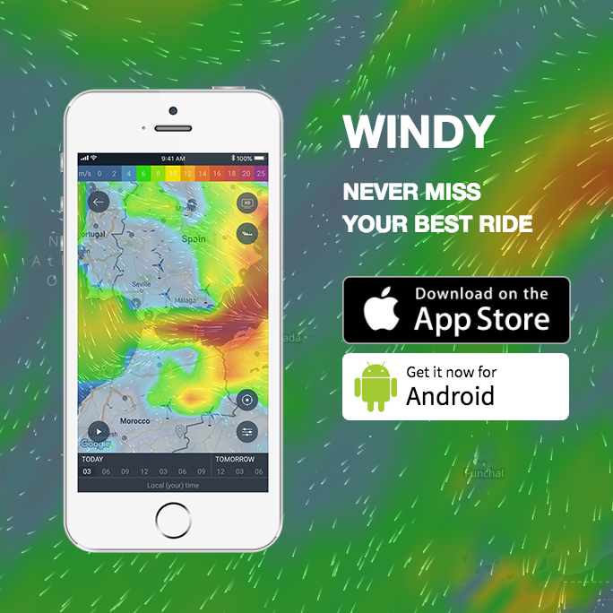
Windy.app: Detailed Meteorological Insights for Drone Pilots
Windy.app is an advanced meteorological tool providing in-depth weather data, including wind gusts, direction, atmospheric pressure, and cloud cover. Its detailed weather maps and forecasts are essential for drone pilots who require accurate and up-to-the-minute weather information for safe flying. The app is also helpful for planning photography sessions, as it gives insights into the best times for capturing stunning aerial images.
B4UFly: Ensuring Regulatory Compliance
For drone pilots in the United States, B4UFly is an essential app. Developed by the FAA, it provides information on where drones can legally fly, helping pilots adhere to federal regulations and avoid restricted areas.


Advanced Drone Applications and Tools
Tesla Field Recorder: A Unique Tool for Drone Operations
The Tesla Field Recorder app offers a unique feature set, especially valuable for detecting magnetic fields. This aspect is crucial since the drone's compass relies on magnetic fields for navigation. The ability to detect and record magnetic activity makes this app an indispensable tool for ensuring drone flight integrity and avoiding potential performance issues.
 Exelerus
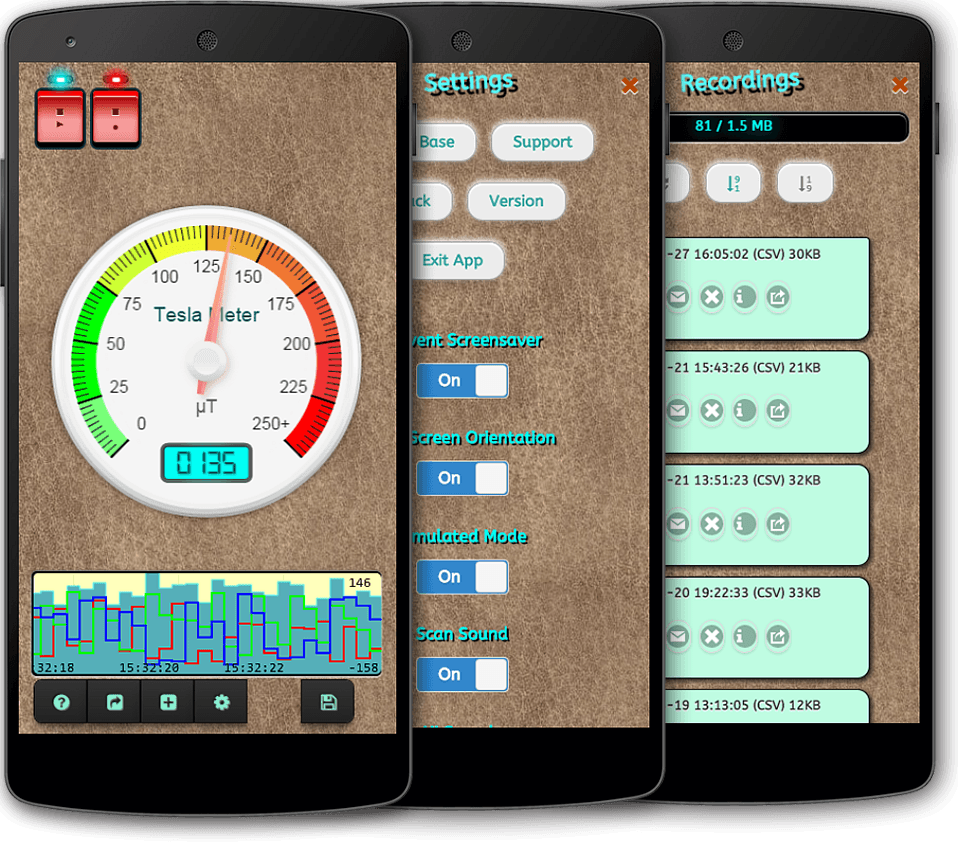
Kittyhawk and Aloft: Comprehensive Drone Operation Apps
Kittyhawk and its successor, Aloft, are versatile tools for drone operators, providing a wide range of functionalities. These apps assist with flight logging, pre-flight planning, live streaming, fleet management, and obtaining FAA approvals. With regular updates adding new features, such as Thermal Camera and Orbit Mode, these apps are valuable for both commercial and recreational drone pilots.
Pix4D and DroneDeploy: Pioneers in Drone Cartography
For those involved in more advanced applications like cartography and 3D modeling, Pix4D and DroneDeploy stand out. These apps transform images captured by drones into detailed maps and 3D models, proving invaluable in fields like agriculture, construction, and land surveying. They offer an intuitive platform for planning flights and processing data for precise models and maps.
Enhancing Drone Photos with Editing Apps
AirMagic: AI-Powered Photo Enhancement
AirMagic is a game-changer for drone photographers, automating the photo enhancement process. Its AI-driven technology enhances drone photos by adjusting midtones, highlights, shadows, and more, eliminating the need for time-consuming manual editing.
Luminar Neo: A Creative Toolbox for Aerial Photos
Luminar Neo is another excellent tool for editing aerial photographs. With features and presets specifically designed for drone photography, it offers a user-friendly interface to enhance photos, balancing tones, colors, and contrasts with ease.

Adobe Lightroom: Precision Editing for Drone Enthusiasts
Adobe Lightroom stands out for its advanced editing capabilities and cloud-syncing feature, perfect for drone photographers who need to edit on multiple devices. With its array of sliders and presets, users can make precise adjustments to color, exposure, and detail, bringing out the best in their aerial shots. The app's ability to handle RAW files directly from the drone is a significant advantage, ensuring high-quality editing results.
Snapseed: A Comprehensive Tool for On-the-Go Editing
Snapseed, a popular photo editing app, offers a range of tools and filters specifically beneficial for drone photography. Its intuitive interface allows for quick adjustments like cropping, rotating, and perspective correction, which are essential for fine-tuning aerial shots. The Selective Adjust tool is particularly useful for drone photographers, enabling them to enhance specific areas of their photos without affecting the entire image.
VSCO: Artistic Flair for Aerial Imagery
VSCO is renowned for its stylish filters and effects, making it a great choice for drone photographers looking to add an artistic touch to their images. The app offers a blend of classic and modern looks, ideal for giving aerial photos a unique and professional finish. VSCO also includes standard editing tools, allowing for basic adjustments before applying its signature filters.
In the rapidly evolving world of drone technology, these apps play a critical role in enhancing the capabilities and experiences of drone users. From ensuring safe and compliant flights to capturing and editing stunning aerial photographs, these apps cover every aspect of modern drone operation.
Conclusion
The advancement in drone apps has significantly broadened the horizons for drone enthusiasts and professionals. By leveraging these tools, one can navigate the skies more safely, capture mesmerizing images, and engage in complex cartographic projects with ease. The world of drone technology continues to evolve, and these apps are at the forefront of this exciting journey.
In conclusion, these drone apps are indispensable for both amateur and professional drone pilots. They not only enhance the flying experience but also ensure adherence to safety and legal guidelines. Understanding and utilizing these apps can significantly improve your drone flying and photography experience.
FAQs
Q: What is the Best App for Drone Photography?
A: For drone photography, PhotoPills is highly recommended. It offers comprehensive features for planning and executing aerial photography, including the alignment of the Sun, Moon, and Milky Way for perfect shots. AirMagic is also great for enhancing photos post-flight.
Q: How Do I Ensure Safe Drone Flying Conditions?
A: UAV Forecast and Hover are essential apps to check before flying. They provide detailed weather forecasts and information about air traffic and potential hazards in your area, ensuring you can fly your drone safely.
Q: Can Drone Apps Help with Regulatory Compliance?
A: Yes, apps like B4UFly and AirMap provide crucial information about no-fly zones and other flight restrictions, helping you comply with local regulations and FAA guidelines, especially in the United States.
Q: Are There Apps for Advanced Drone Operations Like Cartography?
A: Pix4D and DroneDeploy are excellent for advanced drone operations like cartography and 3D modeling. They enable users to create detailed maps and models from drone-captured images.
Q: What Apps Can I Use to Enhance My Drone Photos Automatically?
A: AirMagic is a fantastic app that automatically enhances your drone photos, adjusting various elements like haze, sky, and details to make your photos breathtaking.